Maps Site map
  FL Maps > County > Lake
Site Map  

Lake County Maps

Click on a thumbnail image to view a full size version of that map.

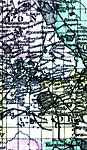
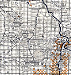
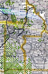
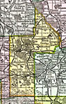
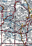
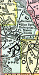
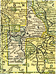
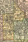
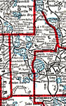
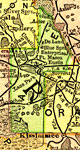
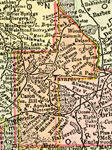
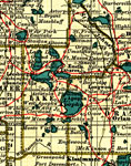
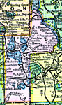
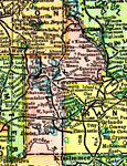
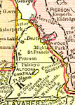
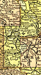
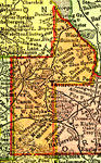
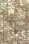
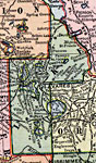
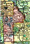
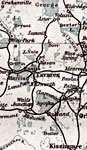
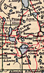
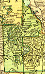
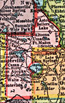
Lake County is Florida's 43rd county, established on May 27, 1887, from segments of Sumter County and Orange County. It gains its name from the abundance of lakes found in this area. Tavares is the county seat.

For earlier maps of this area, visit the Sumter County and Orange County map galleries.


  Record   1   to   23  of   23

Lake County, 1886
This is a detailed map of Lake County, Florida showing the County Seat, major cities, roads, railroads, inland waters, etc. Township and range grid established from the Tallahassee baseline and meridian shows the extent of land survey in the county i...

Lake County, 1890
A map of Lake County showing county lines, the county seat (Tavares), railroads, and cities current to 1890....

Lake County, 1890
A map of Lake County showing the county seat (Tavares), cities, towns, rivers, lakes, roads, and railroads present in 1890....

Lake County, 1893
A map of Lake County showing county lines, the county seat (Tavares), and railroads connecting the major cities current to 1893....

Lake County, 1894
A map of Lake County showing county lines, the county seat (Tavares), railroads, and cities current to 1894....

Lake County, 1895
This Florida map of Lake County outlines the county boundary and railroads connecting the major cities, current to 1895. ...

Lake County, 1897
A map of Lake County showing forts, towns, bodies of water, county lines, the county seat (Tavares), and railroads connecting the major cities current to 1897. Township and Range grids extending from the Tallahassee Meridian and Tallahassee Base Line...

Lake County, 1898
A map of Lake County as of 1898 showing rivers, lakes, railroads, towns, and the county seat, Tavares....

Lake County, 1898
A map of Lake County showing county lines, the county seat (Tavares), and railroads connecting the major cities current to 1898....

Lake County, 1900
A map of Lake County showing county lines, the county seat (Tavares), railroads, and cities current to 1900....

Lake County, 1904
A map of Lake County showing county lines, the county seat (Tavares), railroads, and cities current to 1904....

Lake County, 1909
A map of Lake County showing county lines, the county seat (Tavares), and railroads connecting the major cities current to 1909....

Lake County, 1911
A map of Lake County showing county lines and railroads connecting the major cities current to 1911....

Lake County, 1911
A map of Lake County showing county lines, the county seat (Tavares), railroads, and cities current to 1911....

Lake County, 1914
A map of Lake County showing county lines, the county seat (Tavares), railroads, and cities current to 1914....

Lake County, 1917
A map of Lake County showing county lines, the county seat (Tavares), railroads, and principal auto routes connecting the major cities current to 1917....

Lake County, 1917
A map of Lake County showing county lines, the county seat (Tavares), railroads, and cities current to 1917....

Lake County, 1921
A map of Lake County showing county lines, the county seat (Tavares), and railroads connecting the major cities current to 1921....

Lake County, 1921
A map of Lake County showing county lines, the county seat (Tavares), railroads, and cities current to 1921....

U. S. internal waterways, midst lakes and hills of Central Florida, 1925
Digitization provided by the USF Libraries Digitization Center. Rare Maps. This is a map showing of internal waterways in Lake County in central Florida, circa 1925. The map states, "Map showing lakes with navigable canals, forming the headwater...

Water Management Districts and Hydrologic Units for Lake County, 1981
This map from the U. S. Geological Survey Open-File Report 81-1060, Estimated Water Use in the Southwest Florida Water Management District and Adjacent Areas, 1980, shows the location of public-supply systems, water management district and hydrologic...

Lake EPA Superfund Sites, 2008
This map shows the location of Lake County s Superfund Site listed on the United States Environmental Protection Agency s National Priorities List (NPL). The map was created based on Environmental Protection Agency (EPA) shapefiles and metadata. Full...

Locater Map of Lake County, 2008
This is a locater map for Lake County, 2008. The state is transparent while the county itself is highlighted by color. ...


  FL Maps > County > Lake
Site Map  

Maps ETC is a part of the Educational Technology Clearinghouse
Produced by the Florida Center for Instructional Technology © 2007
College of Education , University of South Florida