Maps Site map
  FL Maps > County > Sumter
Site Map  

Sumter County Maps

Click on a thumbnail image to view a full size version of that map.

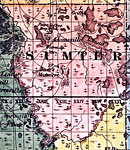
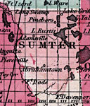
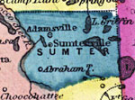
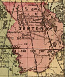
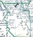
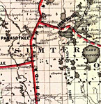
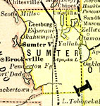
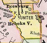
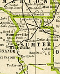
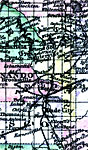
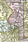
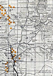
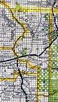
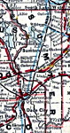
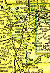
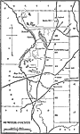
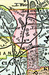
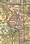
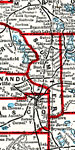
Sumter County is Florida's 29th county, established on January 8, 1853, from a segment of Orange County. It gains its name from Thomas Sumter (1736-1832), a prominent general of southern campaigns during the Revolutionary War. Bushnell is the county seat.

For earlier maps of this area, visit the Orange County map gallery.


  Record   1   to   25  of   30

Sumter County, 1857
A map of Sumter county as of 1857 showing towns, forts, bodies of water, and the county seats....

Sumter County, 1859
Railroad map of Sumter County, Florida showing river drainage, cities and towns, and roads in 1859. Township grids based on the Tallahassee basis parallel and the Tallahassee prime meridian shows the extent of land survey in Florida. The map scale is...

Sumter County, 1860
A map of Sumter County as of 1860 showing towns, rivers, lakes, and the county seat....

Sumter County, 1880
This map of Sumter County shows the county seat (Leesburg) and cities current to 1880....

Sumter County, 1880
A map of Sumter County showing county lines, the county seat (Leesburg), railroads, and cities current to the 1880s....

Sumter County, 1883
A map of Sumter County showing county lines, the county seat (Sumterville), and railroads connecting the major cities current to 1883....

Sumter County, 1883
Digitization provided by the USF Libraries Digitization Center. This Sumter County map is from Poor s railroad map of Florida, circa 1883. It shows railroads, counties and county seats, cities and towns and inland waters. Approximate map scale is 75 ...

Sumter County, 1886
A map of Sumter County showing county lines, the county seat (Sumterville), and railroads connecting the major cities current to 1886....

Sumter County, 1886
This is a detailed map of Sumter County, Florida showing the County Seat, major cities, roads, railroads, inland waters, etc. Township and range grid established from the Tallahassee baseline and meridian shows the extent of land survey in the county...

Sumter County, 1888
A map of Sumter County showing county lines, the county seat (Sumterville), railroads, and cities current to 1888....

Sumter County, 1890
A map of Sumter County showing towns, bodies of water, county lines, the county seat (Sumterville), and railroads connecting the major cities current to 1890. ...

Sumter County, 1890
A map of Sumter County showing the county seat (Sumterville), cities, towns, rivers, lakes, roads, and railroads present in 1890....

Sumter County, 1893
A map of Sumter County showing county lines, the county seat (Sumterville), and railroads connecting the major cities current to 1893....

Sumter County, 1894
A map of Sumter County showing county lines, the county seat (Sumterville), railroads, and cities current to 1894....

Sumter County, 1895
This Florida map of Sumter County outlines the county boundary and railroads connecting the major cities, current to 1895. ...

Sumter County, 1897
A map of Sumter County showing forts, towns, bodies of water, county lines, the county seat (Sumterville), and railroads connecting the major cities current to 1897. Township and Range grids extending from the Tallahassee Meridian and Tallahassee Bas...

Sumter County, 1898
A map of Sumter County as of 1898 showing rivers, railroads, towns, and the county seat, Sumterville....

Sumter County, 1898
A map of Sumter County showing county lines, the county seat (Sumterville), and railroads connecting the major cities current to 1898....

Sumter County, 1898
Digitization provided by the USF Libraries Digitization Center. Rare Maps. This is a detail map of Sumter county circa 1898. This map shows section township range (STR). Main cities and towns are shown such as the county seat Sumterville. Inland wate...

Sumter County, 1899
A map of Sumter County showing county lines, the county seat (Sumterville), and railroads connecting the major cities current to 1899....

Sumter County, 1900
A map of Sumter County showing county lines, the county seat (Sumterville), railroads, and cities current to 1900....

Sumter County, 1900
A map of Sumter County showing county lines, the county seat (Sumterville), railroads, and cities current to 1900....

Sumter County, 1904
A map of Sumter County showing county lines, the county seat (Sumterville), railroads, and cities current to 1904. ...

Sumter County, 1911
A map of Sumter County showing county lines, the county seat (Sumterville), railroads, and cities current to 1911....

Sumter County, 1917
A map of Sumter County showing county lines, the county seat (Sumterville), railroads, and principal auto routes connecting the major cities current to 1917....

Next Last


  FL Maps > County > Sumter
Site Map  

Maps ETC is a part of the Educational Technology Clearinghouse
Produced by the Florida Center for Instructional Technology © 2007
College of Education , University of South Florida