Maps Site map
  FL Maps > Region > 1880-1899
Site Map  

  Record   26   to   36  of   36

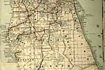
Detail - Florida, 1889
Detail from the 1899 Bradley's Atlas showing the northern Florida peninsula, with counties, railroads, cities, inland waters, etc. Includes Township and Range grid. Digitization provided by the USF Libraries Digitization Center. Rare Maps. Map scale...

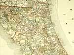
Detail - Florida, 1889
Detail from the 1899 Bradley's Atlas showing the central Florida peninsula, with counties, railroads, cities, inland waters, etc. Includes Township and Range grid. Digitization provided by the USF Libraries Digitization Center. Rare Maps. Map scale ...

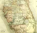
Everglades and South Florida, 1890
A map of the southern tip of peninsular Florida showing Lake Okeechobee, the Big Cypress Swamp, the Big Sawgrass Swamp, and the Everglades. Existing drainage canals are shown to the southwest of Lake Okeechobee and a proposed canal to the northeast, ...

Phosphate Plants of Manatee, Polk, Lee, and Hillsborough, 1891
Digitization provided by the USF Libraries Digitization Center. Rare Maps. This is a map of Manatee, Polk, Lee and Hillsborough counties circa 1891. It shows phosphate plants in these counties that are in operation (letters) and those that are in th...

Lake Okeechobee and Everglades, 1897
A map of the southern tip of peninsular Florida showing Lake Okeechobee, the Big Cypress Swamp, and the Everglades. The map shows existing and proposed drainage canals at the southwest end of Lake Okeechobee current to 1897, before the large Evergla...

Map Showing Parts of Lake, Orange and Volusia Counties, 1898
Digitization provided by the USF Libraries Digitization Center. Rare Maps. This is a detail map of Lake, Orange and Volusia counties circa 1898. This map shows section township range (STR). Main cities and towns are shown such as the county seat of O...

Detail - Florida, 1898
This detail is from an 1898 Rand McNally map of Florida. The detail shows the panhandle region of Florida, with county lines and county seats of the period, major towns, railroad lines, rivers, and coastline. This map shows section township range (S...

Detail - Florida, 1898
This detail is from an 1898 Rand McNally map of Florida. The detail shows the northern peninsula region of Florida, with county lines and county seats of the period, major towns, railroad lines, rivers, and coastline. This map shows section township...

Detail - Florida, 1898
This detail is from an 1898 Rand McNally map of Florida. The detail shows the southern peninsula region of Florida, with county lines and county seats of the period, major towns, railroad lines, rivers, and coastline. This map shows section township...

Detail - Florida, 1898
This detail is from an 1898 Rand McNally map of Florida. The detail shows the southernmost peninsula region and Florida Keys, with county lines and county seats of the period, major towns, rivers, and coastline. This map shows section township range...

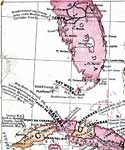
Detail - Goff's historical map of the Spanish-American War in the West Indies, 1899
A detail from Goff's 1898 historical map of the Spanish-American War in the West Indies, showing the central to southern portion of the Florida peninsula and the northern portion of Cuba. Railroads, major cities, lighthouses, and U.S. Army forts are ...

First Previous


  FL Maps > Region > 1880-1899
Site Map  

Maps ETC is a part of the Educational Technology Clearinghouse
Produced by the Florida Center for Instructional Technology © 2007
College of Education , University of South Florida