| Home > Maps > State Outlines | |
These state and regional maps are appropriate for many types of class activities. The black and white ones will photocopy well. Choose the style you wish by clicking on the appropriate button next to the county name.
All of the maps on this page are in PDF (Portable Document Format) and are sized to print on regular letter-sized paper.
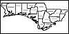
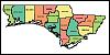
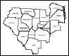
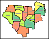
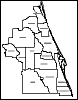
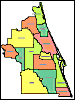
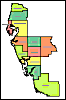
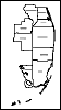
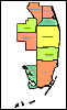
Florida's Northwest Counties. A black and white map labeling Florida's northwest counties. Florida's Northwest Counties. A color map labeling Florida's northwest counties. Florida's Northeast Counties. A black and white map labeling Florida's northeast counties. Florida's Northeast Counties. A color map labeling Florida's northeast counties. Florida's Central Counties. A black and white map labeling Florida's central counties. Florida's Central Counties. A color map labeling Florida's central counties. Florida's Southwest Counties. A black and white map labeling Florida's southwest counties. Florida's Southwest Counties. A color map labeling Florida's southwest counties. Florida's Southeast Counties. A black and white map labeling Florida's southeast counties. Florida's Southeast Counties. A color map labeling Florida's southeast counties.
| Home > Maps > State Outlines |
Exploring
Florida: A Social Studies Resource for Students and Teachers
Produced by the Florida Center for Instructional
Technology,
College of Education, University of South Florida © 2002.