|
|
|
| FL Maps > Region > 1840-1859 |
|
Cedar Keys: A General Reconnoissance of the Western Coast of Florida,
1851 |
|
Tampa Bay: A General Reconnoissance of the Western Coast of Florida,
1851 |
|
Charlotte Harbor: A General Reconnoissance of the Western Coast of Florida,
1851 |
|
Florida Keys: A General Reconnoissance of the Western Coast of Florida,
1851 |
|
A General Reconnoissance of the Western Coast of Florida,
1851 |
|
Diagram of St. Augustine Land District,
1855 |
|
Diagram of Tampa Land District,
1855 |
|
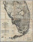
Military map of the peninsula of Florida south of Tampa Bay,
1856 |

|
Map of the Everglades,
1859 |

|
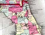
Detail - Johnson's new railroad & county copper plate map of the southern states from the latest and best information,
1859 |
|
Detail - Johnson's new railroad & county copper plate map of the southern states from the latest and best information,
1859 |
|
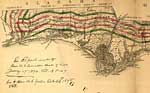
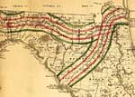
Detail - Map of the State of Florida showing the progress of the surveys accompanying annual report of the Surveyor General,
1859 |
|
Detail - Map of the State of Florida showing the progress of the surveys accompanying annual report of the Surveyor General,
1859 |
| FL Maps > Region > 1840-1859 |
Maps ETC
is a part of the
Educational Technology Clearinghouse
Produced by the
Florida Center for Instructional Technology
© 2007
College of Education
,
University of South Florida