|
|
|
| FL Maps > Region > 1720-1739 |
|
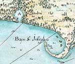
Detail - Carte de la cote de la Louisiane depuis la Baye St. Joseph,
1732 |
|
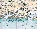
Detail - Carte de la cote de la Louisiane depuis la Baye St. Joseph,
1732 |
| FL Maps > Region > 1720-1739 |
Maps ETC
is a part of the
Educational Technology Clearinghouse
Produced by the
Florida Center for Instructional Technology
© 2007
College of Education
,
University of South Florida