|
|
|
| FL Maps > Local > St. Johns |
Click on a thumbnail image to view a full size version of that map.
|
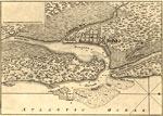
Map of Fort Matanzas,
1742 |
|
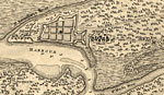
St. Augustine Fort,
1756 |
|
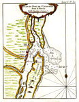
A plan of the land between Fort Mossy and St. Augustine,
1760s |
|
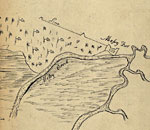
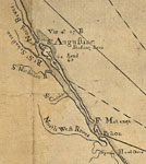
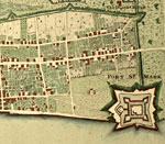
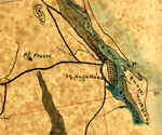
Detail - A plan of the land between Fort Mossy and St. Augustine,
1760s |
|
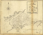
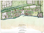
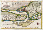
Plan of the Town and Harbour of St. Augustine,
1762 |
|
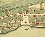
Detail - Plan of the Town and Harbour of St. Augustine,
1762 |
|
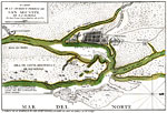
Plan Du Port De St. Augustin dans la Floride No. 39,
1764 |
|
Detail - East and West Florida,
1774 |
|
Plan of the Town of St. Augustine the capital of East Florida,
1777 |
|
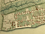
Detail - Plan of the Town of St. Augustine the capital of East Florida,
1777 |
|
Detail - Plan of the Town of St. Augustine the capital of East Florida,
1777 |
|
Detail - Plan of the Town of St. Augustine the capital of East Florida,
1777 |
|
Plan of the Town and Harbour of St. Augustin in East Florida,
1783 |
|
Plano de la ciudad de San Agustin de la Florida,
1783 |
|
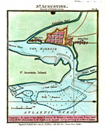
St. Augustine Engraved for Luffman's Select Plans,
1802 |
|
Saint Augustine,
1850 |
|
Detail - Map of the cost [sic] of Georgia & Florida,
1863 |
|
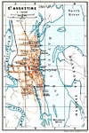
St. Augustine,
1890 |
|
St. Augustine,
1890 |
|
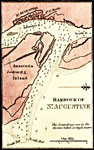
Plan of Fort Marion,
1890 |

|
Map of St. Augustine,
1898 |
|
St. Augustine,
1909 |
|
Bakersville,
1936 |
|
Durbin,
1936 |
|
Elkton,
1936 |
| Next | Last |
| FL Maps > Local > St. Johns |
Maps ETC
is a part of the
Educational Technology Clearinghouse
Produced by the
Florida Center for Instructional Technology
© 2007
College of Education
,
University of South Florida