Maps Site map
  FL Maps > County > Liberty
Site Map  

Liberty County Maps

Click on a thumbnail image to view a full size version of that map.

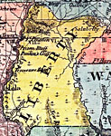
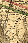
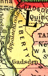
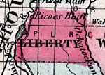
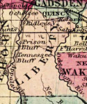
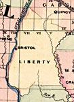
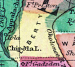
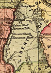
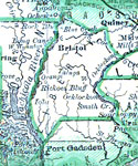
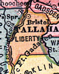
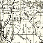
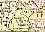
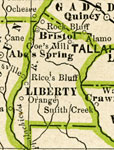
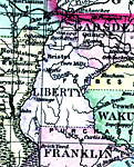
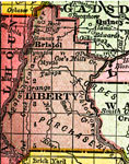
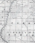
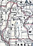
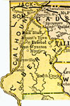
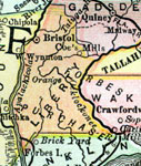
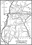
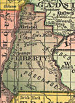
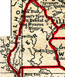
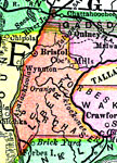
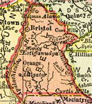
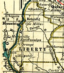
Liberty County is Florida's 34th county, established on December 15, 1855, from a segment of Gadsden County. It gains its name from one of the driving principles of the creation of the United States - "liberty." Bristol is the county seat.

For earlier maps of this area, visit the Gadsden County map gallery.


  Record   1   to   25  of   30

Liberty County, 1860
A map of Liberty County as of 1860 showing towns and rivers....

Liberty County, 1880
This map of Liberty County shows the county seat (Bristol) and cities current to 1880....

Liberty County, 1883
A map of Liberty County showing county lines, the county seat (Brlistol), and railroads connecting the major cities current to 1883....

Liberty County, 1886
A map of Liberty County showing county lines, the county seat (Bristol), and railroads connecting the major cities current to 1886....

Liberty County, 1886
This is a detailed map of Liberty County, Florida showing the County Seat, major cities, roads, railroads, inland waters, etc. Township and range grid established from the Tallahassee baseline and meridian shows the extent of land survey in the count...

Liberty County, 1888
A map of Liberty County showing county lines, the county seat (Bristol), and cities current to 1888....

Liberty County, 1890
A map of Liberty County showing major cities, towns, bodies of water, county lines, and the county seat (Bristol) current to 1890. ...

Liberty County, 1890
A map of Liberty County showing county lines, the county seat (Bristol), and cities current to 1890....

Liberty County, 1890
A map of Liberty County showing the county seat (Bristol), cities, towns, rivers, lakes, and roads present in 1890....

Liberty County, 1893
A map of Liberty County showing county lines, and the county seat (Bristol) current to 1893....

Liberty County, 1894
A map of Liberty County showing county lines, the county seat (Bristol), and cities current to 1894....

Liberty County, 1895
This Florida map of Liberty County outlines the county boundary and railroads connecting the major cities, current to 1895. ...

Liberty County, 1897
A map of Liberty County showing forts, major cities, towns, bodies of water, county lines, the county seat (Bristol) current to 1897. Township and Range grids extending from the Tallahassee Meridian and Tallahassee Base Line are shown....

Liberty County, 1898
A map of Liberty County as of 1898 showing rivers, towns, and the county seat, Bristol....

Liberty County, 1898
A map of Liberty County showing county lines, the county seat (Bristol), and railroads connecting the major cities current to 1898....

Liberty County, 1898
Digitization provided by the USF Libraries Digitization Center. Rare Maps. This is a detail map of Liberty county circa 1898. This map shows section township range (STR). Main cities and towns are shown such as the county seat Bristol. Inland waters ...

Liberty County, 1899
A map of Liberty County showing county lines, the county seat (Bristol), and railroads connecting the major cities current to 1899....

Liberty County, 1900
A map of Liberty County showing county lines, the county seat (Bristol), railroads, and cities current to 1900....

Liberty County, 1904
A map of Liberty County showing county lines, the county seat (Bristol), railroads, and cities current to 1904....

Liberty County, 1909
A map of Liberty County showing county lines, the county seat (Bristol), and railroads connecting the major cities current to 1909....

Liberty County, 1911
A map of Liberty County showing county lines and railroads connecting the major cities current to 1911....

Liberty County, 1911
A map of Liberty County showing county lines, the county seat (Bristol), railroads, and cities current to 1911....

Liberty County, 1914
A map of Liberty County showing county lines, the county seat (Bristol), railroads, and cities current to 1914....

Liberty County, 1916
This map of Liberty County shows the county seat (Bristol), county boundaries, wetlands, railroads, and cities current to 1916....

Liberty County, 1917
A map of Liberty County showing county lines, the county seat (Bristol), railroads, canals and principal auto routes connecting the major cities current to 1917....

Next Last


  FL Maps > County > Liberty
Site Map  

Maps ETC is a part of the Educational Technology Clearinghouse
Produced by the Florida Center for Instructional Technology © 2007
College of Education , University of South Florida